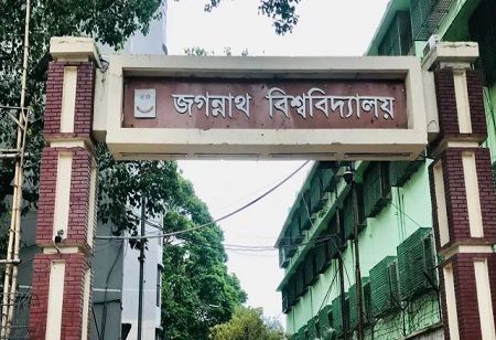
Jagannath University (JnU) has got access to satellite data prepared by the China National Space Administration. This means apparently that better research avenues on disaster management as well as environment will be possible not only for academics but also for the students. Such critical fields' research initiatives and collaborative projects are to broaden.
The formal handover of this data-sharing arrangement took place at an event, involving the Department of Geography and Environment at JnU and the Earth Observation System and Data Center of the China National Space Administration.
Professor Dr Md Monzur Morshed Bhuiya, acting vice-chancellor of JnU and chief guest at the event, said: "This remote sensing satellite data collaboration will significantly enrich our university's research and educational activities. Through this partnership with the China National Space Administration, we will gain enhanced access to satellite data, which will play a crucial role in disaster management and environmental research, and set an example for other universities in Bangladesh".
Special guests included Professor Dr Mallik Akram Hossain, Dean of the Faculty of Earth and Life Sciences, and Professor Dr Yu Wenyiang from the Chinese Academy of Sciences.
Dr Mohammad Abdul Quader, Chair of the Department of Geography and Environment, explained that researchers and students at JnU and other universities across Bangladesh will now have the opportunity to use GF 1-7 satellite data for any location within the country.
This will aid cutting-edge research in areas like environmental changes, land use, climate change, disaster management, and urban planning.
Additionally, this satellite data will enable advanced geospatial analysis, providing valuable insights for observing the impacts of climate change, improving agricultural productivity, conserving forests, and supporting urban development planning.
The researchers will get more precise and accurate data for spatial analysis and mapping, which will enhance research and development activities throughout different areas of Bangladesh. The management of data platform will be handled by department members of the Department of Geography and Environment, JnU- Professors Dr. Riffat Mahmood, Dr. Abdul Malak and Khandaker Tanvir Hossain. Faculty members from Dhaka University's Department of Geology and Jahangirnagar University's Institute of Remote Sensing and GIS attended the ceremony.

